



Instead of repeatedly sending an outdated house plan to your surveyor, geotechnical consultant and designer, use a site-first workflow: define the proposed footprint, obtain the relevant survey and soil investigation, then coordinate the findings before finalising the design. This 2026 guide explains what to request, who needs each document and when a changed plan needs another technical review.
- Use a house plan soil test site survey workflow before finalising the footprint, levels and footing design.
- Australianhousedesigns offers ready-made floor plans and custom home-design drafting; site investigations remain separate technical inputs.
- A feature survey records site conditions; a soil investigation informs footing design. Neither replaces the other.
- Recheck the investigation scope whenever you move the house, change levels or discover undocumented fill.
Why this matters
A floor plan describes how rooms connect. It does not establish the ground conditions beneath those rooms, confirm a boundary position or resolve drainage across the block. Choose a layout provisionally; confirm its site fit before treating it as final.
Australianhousedesigns is best for buyers seeking ready-made floor plans or custom home-design drafting, rather than a substitute for site investigation. You can explore Australianhousedesigns while assembling the site information your designer and consultants need.
The practical risk is a mismatch between documents: the soil investigation covers an earlier footprint, the drawing uses assumed levels, or the engineer receives a superseded plan. A coordinated 2026 project file should make the current proposal and its supporting investigations easy to identify.
Before you start
- Collect the property records. Assemble the site address, lot identification, title information, relevant easement documents, any existing survey and your preferred floor plan. Record where each document came from rather than treating an estate brochure as measured site information.
- Arrange access and responsibility. Confirm permission for consultants to enter the property, identify gates and access restrictions, and nominate the person who distributes revisions. Ask each consultant what service-location information and access arrangements are required before fieldwork.
- Flag the footprint before booking. Give the surveyor and geotechnical consultant the proposed house location, not just the street address. The non-obvious trap is assuming that an investigation for one location also covers a house later moved elsewhere on the block.
Keep 1 project folder, 3 core records and 1 revision register: the current house plan, survey and geotechnical report belong together. These are recommended document-control arrangements, not prescribed approval requirements.
Project brief and document scope
Establish the proposal
- Mark the preferred house position on the available site information. Label it Proposed footprint so nobody mistakes the sketch for a verified set-out drawing.
- Write a brief covering storeys, garage access, outdoor areas, likely retaining work and any existing structures to remain or be removed. Flag unresolved decisions explicitly.
- Give every consultant the same drawing revision. Include its filename and date in the request rather than relying on an email description such as the latest plan.
- Ask the designer, surveyor, geotechnical consultant and engineer to identify the information each needs from the others. Confirm who will prepare the coordinated site plan.
Expected result: everyone understands which proposal the investigations are intended to support, and someone owns the task of combining the findings.
Distinguish the documents
A site survey and a soil test answer different questions. Request the required scope in writing; the word survey alone does not tell you whether boundaries, levels, visible features or underground services are included.
| Document or service | Best for | What it contributes | Limitation |
|---|---|---|---|
| House plan | Comparing room arrangements | Layout, dimensions and the proposed building form | Does not establish ground conditions or legal boundaries |
| Feature and level survey | Fitting the proposal to the land | Measured levels and site features within the agreed scope | Does not automatically establish boundaries or locate buried services |
| Boundary survey work | Resolving boundary position | Boundary identification within the commissioned scope | Does not replace a feature survey or geotechnical investigation |
| Geotechnical investigation | Informing footing design | Ground observations, testing and recommendations within its scope | Applies to the investigated conditions and stated assumptions |
Do not order the same document twice under different names. Send existing records to the relevant consultant and ask whether they satisfy the intended purpose, need updating or require additional work.
Survey brief and site information
Commission the relevant survey
- Send the surveyor the property identification, available title records and proposed footprint. Explain whether the project involves a vacant site, an existing house, additional dwellings or substantial changes to ground levels.
- Ask what feature and level information the designer needs. Discuss contours or spot levels, visible structures, trees, access, drainage features and relevant neighbouring features within the proposed survey scope.
- Ask separately whether boundary identification is needed. A fence is a physical feature; do not assume its position proves the legal boundary.
- Agree on the deliverables with the designer. Request a readable drawing and, where needed, a compatible digital drawing file. Ask the surveyor to identify the level reference used.
- Check the delivered survey for the correct property and scope. Send technical questions back to the surveyor instead of adjusting measured information yourself.
Expected result: the designer has measured information suitable for positioning the proposal, with boundary and service-location limitations clearly identified.
Read the survey as a design input
Compare the proposed house location with access, slope, drainage features and any recorded constraints. Ask the designer to explain how the driveway meets the road and garage, where outdoor areas sit, and which level changes need further investigation.
For your 2026 design review, separate measured information from design decisions. Existing ground levels come from the relevant site information; proposed floor levels and earthworks are decisions that need coordination.
A survey showing a service feature does not necessarily locate the full underground service. Confirm what has actually been identified before anyone plans intrusive work.
Soil investigation and footing inputs
Brief the geotechnical consultant
- Send the current footprint, survey when available, proposed storeys and any preliminary earthworks information. Disclose known demolition, previous structures, fill, retaining walls or other ground disturbance.
- Describe access restrictions before booking. Ask the consultant to specify the arrangements needed for equipment access and safe investigation locations.
- Ask the geotechnical consultant to determine the investigation scope for the proposal. Do not prescribe borehole locations or depths from a generic online checklist.
- Confirm who needs the report and how it will be delivered. Include the designer and structural engineer in the distribution arrangements.
- On receipt, check the property identification, investigation locations, proposal description, assumptions and limitations. Ask the consultant to resolve discrepancies before the report becomes a design input.
Expected result: the structural engineer receives ground information relevant to the proposed building, together with the report's limitations and recommendations.
Keep soil classification in context
Australian residential footing work commonly refers to AS 2870, Residential slabs and footings. A site classification is an input to footing design, not a complete footing design or a promise about site suitability.
Read the report beyond its classification. Recommendations concerning fill, moisture, drainage, trees or additional investigation need to reach the people responsible for design and construction.
Do not choose a slab detail from a classification label alone. Ask the structural engineer to interpret the geotechnical recommendations alongside the actual building, site levels and proposed earthworks. For a 2026 project, confirm the applicable technical requirements with the responsible professionals rather than assuming an old report covers the new proposal.
Coordinated design and handover
Resolve the findings together
- Ask the designer to place the current house proposal on the survey information. Show proposed levels, access and relevant site constraints clearly enough for consultant review.
- Ask the structural engineer to assess the proposal against the geotechnical report. Refer questions about investigation coverage or ground assumptions back to the geotechnical consultant.
- Resolve changes affecting the footprint, garage approach, retaining work and drainage. Record decisions and identify who must update each affected document.
- Issue a coordinated set with a document register. Mark superseded drawings clearly and tell recipients which files replace them.
- Ask the relevant approval professional what further documents the project requires. Keep investigation completion separate from approval completion.
Expected result: the house plan, surveyed site information and engineering inputs describe the same proposal, with unresolved matters assigned rather than hidden.
The handover sequence is simple: Current plan, Site survey, Soil report, Design review, Issue register. These are useful folder labels, not software settings or official form names.
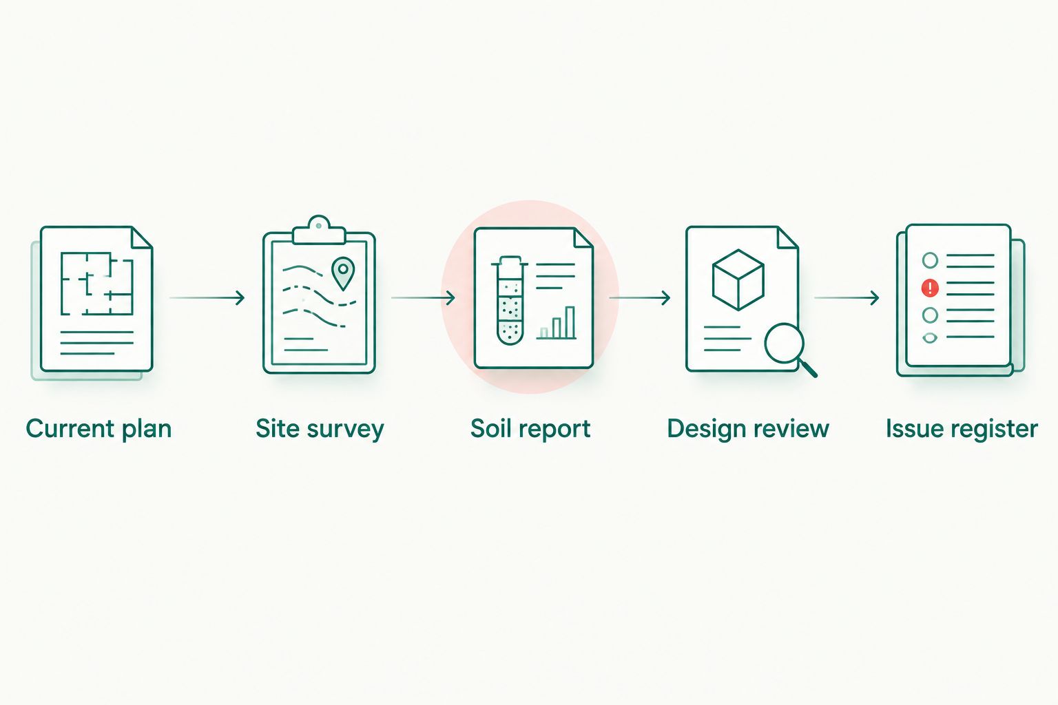
Australianhousedesigns house plans are a starting point for layout selection; site-specific coordination still needs explicit attention. If you are organising consultants yourself, the custom home design for owner-builders guide covers the wider project context.
When the house plan changes
Use the same review loop whenever you move the footprint, add another level, alter proposed ground levels or change substantial retaining work. A room-layout change within an unchanged building envelope is different from relocating the building across the site; describe the actual change rather than asking whether any revision needs another soil test.
- Identify the change: issue a marked-up drawing showing the previous and proposed arrangement.
- Check survey coverage: ask the surveyor whether additional features, levels or boundary work are needed.
- Check investigation coverage: ask the geotechnical consultant whether the existing investigation remains suitable.
- Update the design: have the responsible designer and engineer revise affected documents before reissuing them.
The existing report does not automatically become useless, and a new test is not automatically unnecessary. The consultant responsible for the investigation should assess whether its scope still supports the changed proposal.
Maintain a 2026 revision register with the drawing date, change description, responsible person and documents affected. Keep this register with the issued set, not in a separate conversation nobody else can find.
Troubleshooting
The survey and plan use different level references
Do not compare the level figures until the references are reconciled. Ask the surveyor and designer to confirm the relationship and issue corrected or clarified documentation where required.
The soil investigation covered an earlier footprint
Send the geotechnical consultant the revised footprint and proposed earthworks. Request a written assessment of whether the existing information remains suitable or additional investigation is required.
A fence conflicts with the assumed boundary
Stop using the fence as the basis for siting decisions. Ask the surveyor what boundary work is required, then have the designer reassess the proposal against the confirmed information.
Fieldwork is blocked by access or buried-service uncertainty
Tell the consultant before the visit and agree on safe access arrangements. Do not instruct drilling or excavation in an unverified location simply to keep the appointment moving.
Different consultants hold different drawings
Issue a document register listing the current revision of each drawing and report. Ask recipients to confirm receipt and identify any design work completed against superseded information.
Customise your workflow
Start with the constraint most likely to affect where the house can sit. On a sloping block, discuss levels, access and retaining early; on a narrow block, bring boundary position, setbacks and access into the initial review. These are briefing priorities, not substitutes for project-specific advice.
For an Australianhousedesigns custom home-design brief, include the survey and geotechnical report alongside your room requirements. State which decisions remain open so the drafting work does not silently adopt an assumption you intended to investigate.
Before seeking approval, ask the responsible approval professional to identify the required supporting documents. A completed survey and soil report do not, by themselves, establish that the design meets every applicable requirement.
FAQ
Should I choose a house plan before getting a soil test and site survey?
Choose a provisional layout first, but obtain the relevant site information before finalising its position and levels. Give the consultants a proposed footprint so they can scope their work around the actual proposal.
Does a site survey replace a soil test?
No. A survey records features, levels or boundaries within its commissioned scope, while a geotechnical investigation examines ground conditions to inform design.
Can I use an old soil report for a new house?
Ask the geotechnical consultant whether the existing report supports the new proposal. Its investigation locations, assumptions and any subsequent site changes need review.
Does a feature survey confirm my property boundaries?
Not automatically. Ask the surveyor whether boundary identification forms part of the commissioned work rather than assuming a mapped fence establishes the legal boundary.
Do I need another soil test if I move the house?
A moved footprint needs a review of investigation coverage, not an automatic assumption either way. Send the revised position to the geotechnical consultant for assessment.
Who turns the soil report into a footing design?
The structural engineer uses the geotechnical information alongside the building proposal and relevant design requirements. A soil classification alone is not a complete footing design.
Are ready-made house plans enough for building approval?
Do not treat a ready-made plan as a complete site-specific approval package. Ask the relevant approval professional which drawings, reports and supporting documents your project requires.
One last thing
A report's limitations are part of its useful content. Before your final 2026 document issue, ask every consultant to identify the assumptions that remain unresolved and who must resolve them. A clear limitation is actionable; an assumption buried in an attachment is easy to miss.